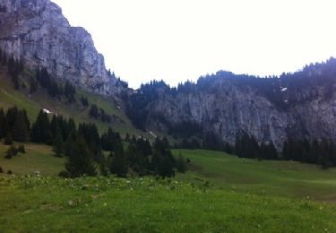
10.4 km | 21 km-effort
la roche étaux bord de larve
Laurent Gachon
User
Length
35 km
Max alt
631 m
Uphill gradient
435 m
Km-Effort
41 km
Min alt
427 m
Downhill gradient
431 m
Boucle
Yes
Creation date :
2024-10-05 10:01:00.158
Updated on :
2024-10-05 13:09:17.408
3h06
Difficulty : Easy
FREE GPS app for hiking
About
Trail Mountain bike of 35 km to be discovered at Auvergne-Rhône-Alpes, Upper Savoy, La Roche-sur-Foron. This trail is proposed by Laurent Gachon.
Positioning
Country:
France
Region :
Auvergne-Rhône-Alpes
Department/Province :
Upper Savoy
Municipality :
La Roche-sur-Foron
Location:
Unknown
Start:(Dec)
Start:(UTM)
292043 ; 5105065 (32T) N.
Comments
Trails nearby
Moussy - Le Pacheux - Passage de la Cache
Walking
Medium
Saint-Laurent,
Auvergne-Rhône-Alpes,
Upper Savoy,
France
3h 35min
Yes
les sambuis
Walking
Easy
Glières-Val-de-Borne,
Auvergne-Rhône-Alpes,
Upper Savoy,
France
7.9 km | 17.7 km-effort
2h 37min
Yes
05-06-2022 Tour de Saint Sixt
Walking
Easy
Amancy,
Auvergne-Rhône-Alpes,
Upper Savoy,
France
8.4 km | 11.7 km-effort
2h 9min
Yes
Circuit de Boëre
Walking
Very easy
Saint-Pierre-en-Faucigny,
Auvergne-Rhône-Alpes,
Upper Savoy,
France
3.2 km | 5.3 km-effort
47min
Yes
les rocailles vers Reignier
Walking
Easy
Scientrier,
Auvergne-Rhône-Alpes,
Upper Savoy,
France
10.7 km | 12.4 km-effort
4h 10min
Yes
Boucle Sur Cou Roche Parnal Chalet de la Balme.gpx
Walking
Very easy
La Roche-sur-Foron,
Auvergne-Rhône-Alpes,
Upper Savoy,
France
11.6 km | 23 km-effort
5h 44min
Yes
Cornier
Horseback riding
Scientrier,
Auvergne-Rhône-Alpes,
Upper Savoy,
France
6.8 km | 7.8 km-effort
1h 6min
Yes
les sambuis
Walking
Difficult
Glières-Val-de-Borne,
Auvergne-Rhône-Alpes,
Upper Savoy,
France
8.7 km | 16.8 km-effort
2h 54min
Yes
GTA_TOTALE_E1
Walking
Very difficult
Saint-Sixt,
Auvergne-Rhône-Alpes,
Upper Savoy,
France
299 km | 549 km-effort
124h 52min
No